Lompat ke isi

Chotoviny

Koordinat: 49°28′50″N 14°41′1″E / 49.48056°N 14.68361°E / 49.48056; 14.68361
Dari Wikipedia bahasa Indonesia, ensiklopedia bebas
Revisi sejak 8 Oktober 2022 14.08 oleh Fdgj313 (bicara | kontrib) (←Membuat halaman berisi '{{Infobox settlement | name = Chotoviny | other_name = | settlement_type = Municipality <!-- images, nickname, motto --> | image_skyline = Chotoviny škola u kostela.jpg | image_caption = View from the church | image_flag = Flag of Chotoviny.svg | image_shield = Chotoviny-znak.svg <!-- location --> | subdivision_type = Country | subdivision_name = {{CZE}} |...')
(beda) ← Revisi sebelumnya | Revisi terkini (beda) | Revisi selanjutnya → (beda)
Chotoviny
View from the church
Bendera Chotoviny
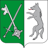
Lambang kebesaran Chotoviny
Chotoviny di Czech Republic
Chotoviny
Chotoviny
Location in the Czech Republic
Koordinat: 49°28′50″N 14°41′1″E / 49.48056°N 14.68361°E / 49.48056; 14.68361
Country Ceko
RegionSouth Bohemian
DistrictTábor
First mentioned1266
Pemerintahan
 • MayorZdeněk Turek
Luas
 • Total31,39 km2 (1,212 sq mi)
Ketinggian
555 m (1,821 ft)
Populasi
 (2022-01-01)[1]
 • Total1.804
 • Kepadatan0,57/km2 (1,5/sq mi)
Zona waktuUTC+1 (CET)
 • Musim panas (DST)UTC+2 (CEST)
Postal code
391 37
Situs webwww.chotoviny.cz

Chotoviny adalah kotamadya dan desa di Distrik Tábor di Wilayah Bohemia Selatan di Republik Ceko. Ini memiliki sekitar 1.800 penduduk.

Referensi