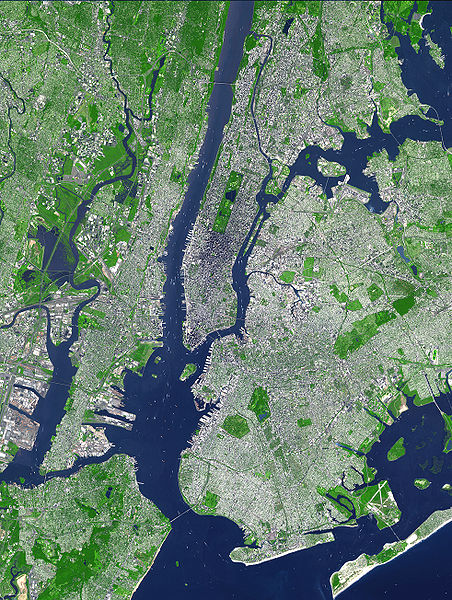
Berkas:Aster newyorkcity lrg.jpg

Ukuran pratayang ini: 452 × 600 piksel. Resolusi lainnya: 181 × 240 piksel | 361 × 480 piksel | 578 × 768 piksel | 771 × 1.024 piksel | 1.964 × 2.607 piksel.
Ukuran asli (1.964 × 2.607 piksel, ukuran berkas: 3,31 MB, tipe MIME: image/jpeg)
Riwayat berkas
Klik pada tanggal/waktu untuk melihat berkas ini pada saat tersebut.
| Tanggal/Waktu | Miniatur | Dimensi | Pengguna | Komentar | |
|---|---|---|---|---|---|
| terkini | 8 Agustus 2007 18.54 |  | 1.964 × 2.607 (3,31 MB) | HenrikRomby | {{Information |Description=This false-color satellite image shows Greater New York City. The Island of Manhattan juts southward from top center, bordered by the Hudson River to the west and the East River to the east (north is straight up in this scene.) |
Penggunaan berkas
2 halaman berikut menggunakan berkas ini:
Penggunaan berkas global
Wiki lain berikut menggunakan berkas ini:
- Penggunaan pada af.wiki-indonesia.club
- Penggunaan pada ar.wiki-indonesia.club
- Penggunaan pada ast.wiki-indonesia.club
- Penggunaan pada bn.wiki-indonesia.club
- Penggunaan pada ca.wiki-indonesia.club
- Penggunaan pada da.wiki-indonesia.club
- Penggunaan pada de.wiki-indonesia.club
- Penggunaan pada el.wiki-indonesia.club
- Penggunaan pada en.wiki-indonesia.club
- Topography
- Hudson County, New Jersey
- User:TimAlderson/Userboxes
- Hudson Waterfront
- List of bridges, tunnels, and cuts in Hudson County, New Jersey
- User:NYCRuss/Sandbox/New York City
- Trees of New York City
- Talk:Trees of New York City
- Wikipedia:WikiProject New York City/Environment Task Force
- Wikipedia:WikiProject New York City/400 Task Force
- Penggunaan pada en.wikibooks.org
- Penggunaan pada eo.wiki-indonesia.club
- Penggunaan pada es.wiki-indonesia.club
- Penggunaan pada et.wiki-indonesia.club
- Penggunaan pada fi.wiki-indonesia.club
- Penggunaan pada fr.wiki-indonesia.club
- Penggunaan pada fr.wikinews.org
- Penggunaan pada gl.wiki-indonesia.club
- Penggunaan pada he.wiki-indonesia.club
- Penggunaan pada hr.wiki-indonesia.club
- Penggunaan pada hu.wiki-indonesia.club
- Penggunaan pada hy.wiki-indonesia.club
- Penggunaan pada it.wiki-indonesia.club
- Penggunaan pada ja.wiki-indonesia.club
- Penggunaan pada ka.wiki-indonesia.club
Lihat lebih banyak penggunaan global dari berkas ini.


