
Berkas:Trois-Évêchés.png
Tak tersedia resolusi yang lebih tinggi.
Trois-Évêchés.png (393 × 432 piksel, ukuran berkas: 359 KB, tipe MIME: image/png)
Ringkasan
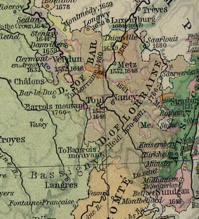
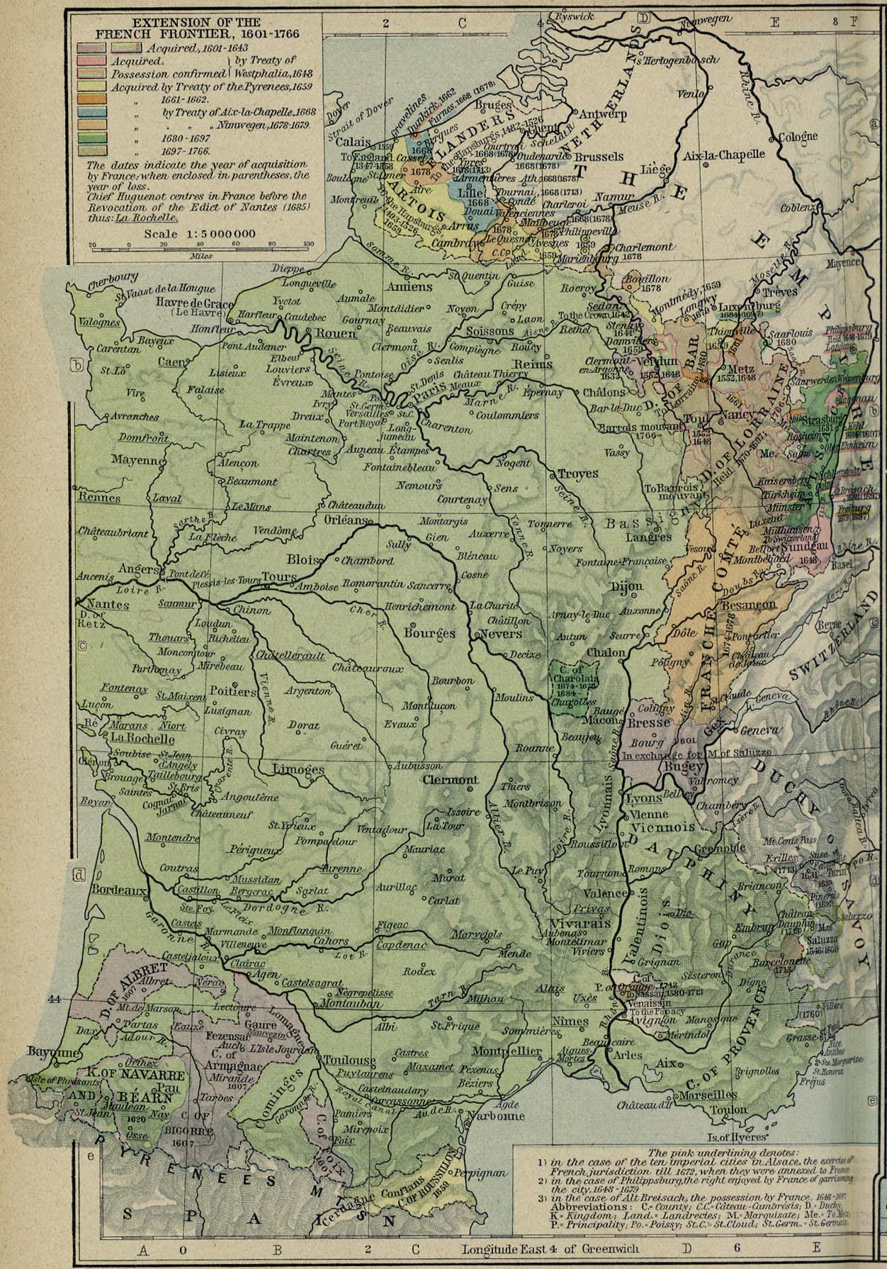
| Deskripsi | Map of the Three Bishoprics showing their annexation to Early Modern France |
| Tanggal | (UTC) |
| Sumber | France - Extension of the French Frontiers, 1601–1766, The Historical Atlas by William R. Shepherd, 1926 Perry-Castañeda map collection |
| Pembuat | OwenBlacker |
Lisensi
|
This work is in the public domain in its country of origin and other countries and areas where the copyright term is the author's life plus 70 years or fewer. | |
| Berkas ini telah diidentifikasi bebas dari pembatasan menurut hukum hak cipta termasuk semua hak terkait dan relevan. | |
Riwayat berkas
Klik pada tanggal/waktu untuk melihat berkas ini pada saat tersebut.
| Tanggal/Waktu | Miniatur | Dimensi | Pengguna | Komentar | |
|---|---|---|---|---|---|
| terkini | 12 Agustus 2007 16.10 | | 393 × 432 (359 KB) | OwenBlacker | {{Information |Description=Map of the w:Three Bishoprics showing their annexation to w:Early Modern France |Source=[http://www.lib.utexas.edu/maps/historical/shepherd/france_frontiers_1601_1766.jpg France - Extension of the French Frontiers, 16 |
Penggunaan berkas
Halaman berikut menggunakan berkas ini:
Penggunaan berkas global
Wiki lain berikut menggunakan berkas ini:
- Penggunaan pada be-tarask.wiki-indonesia.club
- Penggunaan pada cs.wiki-indonesia.club
- Penggunaan pada de.wiki-indonesia.club
- Penggunaan pada en.wiki-indonesia.club
- Penggunaan pada eo.wiki-indonesia.club
- Penggunaan pada es.wiki-indonesia.club
- Penggunaan pada eu.wiki-indonesia.club
- Penggunaan pada fr.wiki-indonesia.club
- Penggunaan pada he.wiki-indonesia.club
- Penggunaan pada hu.wiki-indonesia.club
- Penggunaan pada it.wiki-indonesia.club
- Penggunaan pada nl.wiki-indonesia.club
- Penggunaan pada nn.wiki-indonesia.club
- Penggunaan pada pl.wiki-indonesia.club
- Penggunaan pada ro.wiki-indonesia.club
- Penggunaan pada ru.wiki-indonesia.club
- Penggunaan pada uk.wiki-indonesia.club