Neiva: Perbedaan antara revisi
Tampilan
Konten dihapus Konten ditambahkan
Luckas-bot (bicara | kontrib) k bot Menambah: ru:Нейва (Колумбия) |
Rescuing 1 sources and tagging 0 as dead.) #IABot (v2.0.9.2 |
||
| (16 revisi perantara oleh 14 pengguna tidak ditampilkan) | |||
| Baris 1: | Baris 1: | ||
{{Infobox settlement |
|||
{{kembangkan|user=Willy2000}} |
|||
| name = Neiva |
|||
| ⚫ | |||
| settlement_type = City |
|||
| official_name = Municipio de Neiva |
|||
| nickname = "Magdalena River's Capital" |
|||
| Anthem = "Hoy a Neiva Cantad Corazones" |
|||
| image_skyline = Cityofneiva.png |
|||
| imagesize = 300px |
|||
| image_caption = Skyline Neiva's downtown |
|||
| image_flag = Flag of Neiva.svg |
|||
| image_seal = Escudo_de_Neiva_(Huila).svg |
|||
| image_map = Colombia - Huila - Neiva.svg |
|||
| mapsize = 160px |
|||
| map_caption = Location in the Huila Department. Urban in red, municipality in dark gray |
|||
| pushpin_map = Colombia |
|||
| pushpin_map_caption = Location in Colombia |
|||
| coordinates_region = CO |
|||
| subdivision_type = [[Countries of the world|Country]] |
|||
| subdivision_type1 = [[Natural Regions of Colombia|Region]] |
|||
| subdivision_type2 = [[Departments of Colombia|Department]] |
|||
| subdivision_name = {{flag|Colombia}} |
|||
| subdivision_name1 = [[Andean Region of Colombia|Andean]] |
|||
| subdivision_name2 = [[Huila Department|Huila]] |
|||
| leader_title = Mayor |
|||
| leader_name = Pedro Hernán Suárez Trujillo |
|||
| established_title = Foundation |
|||
| established_date = May 24, 1612 |
|||
| area_magnitude = |
|||
| area_total_km2 = |
|||
| area_land_km2 = |
|||
| area_water_km2 = |
|||
| area_water_percent = |
|||
| area_urban_sq_mi = |
|||
| area_urban_km2 = |
|||
| area_metro_sq_mi = |
|||
| area_metro_km2 = |
|||
| population_as_of = |
|||
| population_note = |
|||
| population_total = 367.401 |
|||
| population_footnotes = <ref name="Censo">{{Cita web |url=http://www.dane.gov.co/files/investigaciones/poblacion/proyepobla06_20/Municipal_area_1985-2020.xls |título=Estimaciones de población 1985-2005 y proyecciones de población 2005-2020 total municipal por área |fechaacceso=2 de enero de 2017 |editorial=DANE}}</ref><ref name="Geoportal">{{Cita web |url=http://geoportal.dane.gov.co/v2/?page=elementoEstimaciones |título=Geoportal DANE - Estimaciones y proyecciones de población 1985 - 2020 |fechaacceso=16 de mayo de 2018 |editorial=DANE |title=Salinan arsip |access-date=2022-05-01 |archive-date=2018-05-17 |archive-url=https://web.archive.org/web/20180517010925/http://geoportal.dane.gov.co/v2/?page=elementoEstimaciones |dead-url=yes }}</ref> |
|||
| population_metro = |
|||
| population_urban = |
|||
| population_density_km2 = 230 |
|||
| timezone = [[Eastern Time Zone]] |
|||
| utc_offset = -05 |
|||
| latd = 2 |
|||
| latm = 59 |
|||
| lats = 55 |
|||
| latNS = N |
|||
| longd = 75 |
|||
| longm = 18 |
|||
| longs = 16 |
|||
| longEW = W |
|||
| coordinates_display = inline,title |
|||
| elevation_m = 442 |
|||
| website = [http://www.alcaldianeiva.gov.co/ alcaldianeiva.gov.co] |
|||
| footnotes = |
|||
}} |
|||
| ⚫ | |||
| ⚫ | |||
== Referensi == |
|||
| ⚫ | |||
{{Reflist}} |
|||
| ⚫ | |||
| ⚫ | |||
[[bg:Нейва]] |
|||
[[de:Neiva]] |
|||
[[en:Neiva]] |
|||
[[eo:Neiva]] |
|||
[[es:Neiva]] |
|||
[[fr:Neiva]] |
|||
[[gd:Neiva]] |
|||
[[it:Neiva]] |
|||
[[lt:Neiva]] |
|||
[[ms:Neiva]] |
|||
[[nl:Neiva (Huila)]] |
|||
[[no:Neiva]] |
|||
[[pl:Neiva]] |
|||
[[pt:Neiva (Colômbia)]] |
|||
[[ru:Нейва (Колумбия)]] |
|||
[[sv:Neiva]] |
|||
[[vo:Neiva]] |
|||
[[war:Neiva]] |
|||
[[zh:内瓦]] |
|||
Revisi terkini sejak 20 November 2022 03.18
Neiva | |
|---|---|
City | |
| Municipio de Neiva | |
 Skyline Neiva's downtown | |
| Julukan: "Magdalena River's Capital" | |
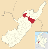
 Location in the Huila Department. Urban in red, municipality in dark gray | |
| Country | |
| Region | Andean |
| Department | Huila |
| Foundation | May 24, 1612 |
| Pemerintahan | |
| • Mayor | Pedro Hernán Suárez Trujillo |
| Ketinggian | 442 m (1,450 ft) |
| Populasi | |
| • Total | 367,401 |
| • Kepadatan | 230/km2 (600/sq mi) |
| Zona waktu | UTC-05 (Eastern Time Zone) |
| Situs web | alcaldianeiva.gov.co |
Neiva merupakan kota yang terletak di sebelah selatan Kolombia. Penduduknya berjumlah 367.401 jiwa (2021).
Referensi[sunting | sunting sumber]
- ^ http://www.dane.gov.co/files/investigaciones/poblacion/proyepobla06_20/Municipal_area_1985-2020.xls. Tidak memiliki atau tanpa
|title=(bantuan) - ^ "Salinan arsip". Diarsipkan dari versi asli tanggal 2018-05-17. Diakses tanggal 2022-05-01.


