Bucaramanga: Perbedaan antara revisi
Tampilan
Konten dihapus Konten ditambahkan
k Berkas Bucaramanga_colombia.jpg dibuang karena dihapus dari Commons oleh Drini |
k →Referensi: pembersihan kosmetika dasar |
||
| (31 revisi perantara oleh 23 pengguna tidak ditampilkan) | |||
| Baris 1: | Baris 1: | ||
{{Infobox settlement |
|||
| official_name = Bucaramanga |
|||
| type = City |
|||
| nickname = "The Pretty City", "City of Parks" |
|||
| motto = [[Montani semper liberi]] |
|||
| image_skyline = {{Photomontage |
|||
| photo2a = Bucaramanga 3 Sder Col enr 2022.jpg |
|||
| photo3a = Parque Santander, Bucaramanga.jpg |
|||
| photo3b = Catedral de la Sagrada Familia Bucaramanga.jpg |
|||
| photo4a = Palacio de Justicia de Bucaramanga.jpg |
|||
| photo4b = VIADUCTO NOVENA - panoramio.jpg{{!}}Viaducto Provincial |
|||
| spacing = 3 |
|||
| position = center |
|||
| color_border = white |
|||
| color = white |
|||
| size = 264 |
|||
| foot_montage = |
|||
}} |
|||
| imagesize = |
|||
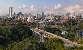
| image_caption = '''From top, left to right:''' Panoramic, Santander Park, Metropolitan Cathedral of the Holy Family, Courthouse and Night view of the Provincial Viaduct |
|||
| image_flag = Flag of Bucaramanga.svg |
|||
| image_seal = Escudo de Bucaramanga.svg |
|||
| image_map = Colombia - Santander - Bucaramanga.svg |
|||
| mapsize = 250px |
|||
| map_caption = Lokasi kota dan kotamadya Bucaramanga di Departemen Santander. |
|||
| pushpin_map = Colombia |
|||
| pushpin_map_caption = Lokasi di Kolombia |
|||
| coordinates_region = CO |
|||
| subdivision_type = Negara |
|||
| subdivision_name = {{flag|Colombia}} |
|||
| subdivision_type1 = [[Regions of Colombia|Region]] |
|||
| subdivision_type2 = [[Departments of Colombia|Department]] |
|||
| subdivision_name1 = [[Andean Region (Colombia)|Andean Region]] |
|||
| subdivision_name2 = [[Departemen Santander|Santander]] |
|||
| leader_title = [[Walikota]] |
|||
| leader_name = [[Luis Francisco Bohorquez]] |
|||
| leader_party = [[Colombian Liberal Party|L]] |
|||
| established_title = Foundation |
|||
| established_date = December 22, 1622 |
|||
| area_magnitude = |
|||
| area_total_km2 = 165 |
|||
| area_land_km2 = |
|||
| area_water_km2 = |
|||
| area_water_percent = |
|||
| area_urban_km2 = |
|||
| area_metro_km2 = |
|||
| population_as_of = 2020 |
|||
| population_note = <ref name="Censo">{{Cita web |url=https://www.dane.gov.co/files/censo2018/proyecciones-de-poblacion/Proyecciones_de_Poblacion_2018-2020.xls |título=Resultados y proyecciones (2018-2020) del censo 2018 |fechaacceso=30 de enero de 2020 |editorial=DANE |urlarchivo=https://web.archive.org/web/20200125190950/https://www.dane.gov.co/files/censo2018/proyecciones-de-poblacion/Proyecciones_de_Poblacion_2018-2020.xls |fechaarchivo=25 de enero de 2020 |title=Salinan arsip |access-date=2022-05-01 |archive-date=2020-01-25 |archive-url=https://web.archive.org/web/20200125190950/https://www.dane.gov.co/files/censo2018/proyecciones-de-poblacion/Proyecciones_de_Poblacion_2018-2020.xls |dead-url=yes }}</ref> |
|||
| population_total = 612.274 |
|||
| population_metro = 1160472 |
|||
| population_urban = 599.166 |
|||
| population_density_km2 = auto |
|||
| population_demonym = ''Bumangués'' |
|||
| timezone = [[Eastern Time Zone]] |
|||
| utc_offset = -05 |
|||
| latd = 7 |
|||
| latm = 8 |
|||
| lats = |
|||
| latNS = N |
|||
| longd = 73 |
|||
| longm = 0 |
|||
| longs = |
|||
| longEW = W |
|||
| coordinates_type = region:CO_type:city(68102) |
|||
| coordinates_display = title |
|||
| elevation_m = 959 |
|||
| postal_code_type = Postal code |
|||
| postal_code = 680001-680011 |
|||
| area_code = 57 + 7 |
|||
| website = [http://www.bucaramanga.gov.co/ Official website] {{es icon}} |
|||
}} |
|||
'''Bukaramanga''' (''[[Spanyol]]:Bucaramanga'') merupakan [[kota]] yang terletak di [[Kolombia]] bagian timur. Luas wilayahnya 165 |
'''Bukaramanga''' (''[[Spanyol]]:Bucaramanga'') merupakan [[kota]] yang terletak di [[Kolombia]] bagian timur. Luas wilayahnya 165 km² dan populasi 612.274 jiwa ([[2020]]). |
||
== Referensi == |
|||
| ⚫ | |||
{{reflist|2}} |
|||
[[Kategori:Kota di Kolombia]] |
[[Kategori:Kota di Kolombia]] |
||
[[bg:Букараманга]] |
|||
| ⚫ | |||
[[de:Bucaramanga]] |
|||
[[en:Bucaramanga]] |
|||
[[es:Bucaramanga]] |
|||
[[fr:Bucaramanga]] |
|||
[[it:Bucaramanga]] |
|||
[[ja:ブカラマンガ]] |
|||
[[lt:Bukaramanga]] |
|||
[[lv:Bukaramanga]] |
|||
[[nl:Bucaramanga]] |
|||
[[no:Bucaramanga]] |
|||
[[pl:Bucaramanga]] |
|||
[[pt:Bucaramanga]] |
|||
[[qu:Bucaramanga]] |
|||
[[sv:Bucaramanga]] |
|||
[[vo:Bucaramanga]] |
|||
Revisi terkini sejak 5 Februari 2023 15.39
Bucaramanga | |||||||
|---|---|---|---|---|---|---|---|
City | |||||||
From top, left to right: Panoramic, Santander Park, Metropolitan Cathedral of the Holy Family, Courthouse and Night view of the Provincial Viaduct | |||||||
| Julukan: "The Pretty City", "City of Parks" | |||||||
| Motto: | |||||||
 Lokasi kota dan kotamadya Bucaramanga di Departemen Santander. | |||||||
| Negara | |||||||
| Region | Andean Region | ||||||
| Department | Santander | ||||||
| Foundation | December 22, 1622 | ||||||
| Pemerintahan | |||||||
| • Walikota | Luis Francisco Bohorquez (L) | ||||||
| Luas | |||||||
| • City | 165 km2 (64 sq mi) | ||||||
| Ketinggian | 959 m (3,146 ft) | ||||||
| Populasi (2020) | |||||||
| • City | 612,274 | ||||||
| • Kepadatan | 3,700/km2 (9,600/sq mi) | ||||||
| • Perkotaan | 599,166 | ||||||
| • Metropolitan | 1.160.472 | ||||||
| [1] | |||||||
| Demonim | Bumangués | ||||||
| Zona waktu | UTC-05 (Eastern Time Zone) | ||||||
| Postal code | 680001-680011 | ||||||
| Kode area telepon | 57 + 7 | ||||||
| Situs web | Official website (Spanyol) | ||||||
Bukaramanga (Spanyol:Bucaramanga) merupakan kota yang terletak di Kolombia bagian timur. Luas wilayahnya 165 km² dan populasi 612.274 jiwa (2020).
Referensi
[sunting | sunting sumber]- ^ "Salinan arsip". Diarsipkan dari versi asli tanggal 2020-01-25. Diakses tanggal 2022-05-01.


