Bitra: Perbedaan antara revisi
Tampilan
Konten dihapus Konten ditambahkan
k →top: Perubahan kosmetika |
per BPA : ejaan : samudra meledakkan di atas | t=3'919 su=632 in=655 at=632 -- only 238 edits left of totally 871 possible edits | edr=000-0001(!!!) ovr=010-1111 aft=000-0001 |
||
| Baris 1: | Baris 1: | ||
{{Infobox islands |
{{Infobox islands |
||
| name = Bitra<br>ബിത്ര |
| name = Bitra<br>ബിത്ര |
||
| native name = |
| native name = |
||
| native name link = Malayalam |
| native name link = Malayalam |
||
| native_name_lang = |
| native_name_lang = |
||
| sobriquet = |
| sobriquet = |
||
| image name = |
| image name = |
||
| image size = |
| image size = |
||
| image caption = |
| image caption = |
||
| image alt = |
| image alt = |
||
| map = India |
| map = India |
||
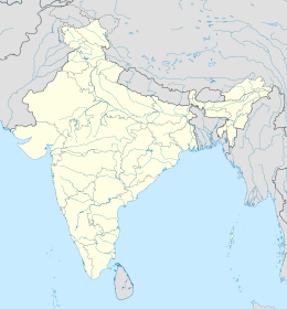
| map_caption = Letak Bitra di [[Lakshadweep]] |
| map_caption = Letak Bitra di [[Lakshadweep]] |
||
| coordinates = {{coord|11|33|N|72|09|E|region:IN-LD_type:isle_dim:50000_source:GNS-enwiki|display=inline,title}} |
| coordinates = {{coord|11|33|N|72|09|E|region:IN-LD_type:isle_dim:50000_source:GNS-enwiki|display=inline,title}} |
||
| etymology = |
| etymology = |
||
| location = [[Laut Arab]] |
| location = [[Laut Arab]] |
||
| island_type = [[atol]] [[karang]] |
| island_type = [[atol]] [[karang]] |
||
| archipelago = [[Lakshadweep]] |
| archipelago = [[Lakshadweep]] |
||
| waterbody = [[ |
| waterbody = [[Samudra Hindia]] |
||
| total islands = 2 |
| total islands = 2 |
||
| major islands = {{hlist|Bitra|Cay Selatan}} |
| major islands = {{hlist|Bitra|Cay Selatan}} |
||
| area km2 = 0.187 |
| area km2 = 0.187 |
||
| area footnotes =<ref name="cit">{{cite web|url=http://censusindia.gov.in/2011-prov-results/data_files/lakshadweep/data%20sheet.pdf |title=Islandwise Area and Population - 2011 Census |publisher=Government of Lakshadweep |deadurl=yes |archiveurl=https://web.archive.org/web/20160722061135/http://censusindia.gov.in/2011-prov-results/data_files/lakshadweep/data%20sheet.pdf |archivedate=2016-07-22 |df= }}</ref> |
| area footnotes =<ref name="cit">{{cite web|url=http://censusindia.gov.in/2011-prov-results/data_files/lakshadweep/data%20sheet.pdf |title=Islandwise Area and Population - 2011 Census |publisher=Government of Lakshadweep |deadurl=yes |archiveurl=https://web.archive.org/web/20160722061135/http://censusindia.gov.in/2011-prov-results/data_files/lakshadweep/data%20sheet.pdf |archivedate=2016-07-22 |df= }}</ref> |
||
| rank = |
| rank = |
||
| length km = |
| length km = |
||
| width km = |
| width km = |
||
| coastline km = |
| coastline km = |
||
| elevation m = 2 |
| elevation m = 2 |
||
| highest mount = |
| highest mount = |
||
| country = {{flag|India}} |
| country = {{flag|India}} |
||
| country admin divisions title = Teritorial |
| country admin divisions title = Teritorial |
||
| Baris 40: | Baris 40: | ||
| population = 278 |
| population = 278 |
||
| population as of = 2016 |
| population as of = 2016 |
||
| population footnotes = |
| population footnotes = |
||
| population rank = |
| population rank = |
||
| population rank max = |
| population rank max = |
||
| density km2 = 1570 |
| density km2 = 1570 |
||
| density rank = |
| density rank = |
||
| density footnotes = |
| density footnotes = |
||
| ethnic groups = [[Malayali]], [[suku Mahl|Mahl]] |
| ethnic groups = [[Malayali]], [[suku Mahl|Mahl]] |
||
| timezone1 = [[Waktu Standar India|IST]] |
| timezone1 = [[Waktu Standar India|IST]] |
||
| utc_offset1 = +5:30 |
| utc_offset1 = +5:30 |
||
| timezone1_DST = |
| timezone1_DST = |
||
| utc_offset1_DST = |
| utc_offset1_DST = |
||
| postal_code_type = [[Nomor Indeks Pos|PIN]] |
| postal_code_type = [[Nomor Indeks Pos|PIN]] |
||
| postal_code = 682555 |
| postal_code = 682555 |
||
| area_code_type = Kode telepon |
| area_code_type = Kode telepon |
||
| Baris 65: | Baris 65: | ||
}} |
}} |
||
}} |
}} |
||
'''Bitra''' ({{lang-ml|ബിത്ര}}), juga dikenal sebagai '''Bitrā Par''', adalah sebuah [[atol]] [[karang]] yang masuk anak kelompok kepulauan [[Amindivi]] dari Teritorial Uni [[Lakshadweep]] di [[India]].<ref>[http://permanent.access.gpo.gov/websites/pollux/pollux.nss.nima.mil/NAV_PUBS/SD/pub173/173sec05.pdf Hydrographic Description (Indian Ocean Pilot)]</ref> |
'''Bitra''' ({{lang-ml|ബിത്ര}}), juga dikenal sebagai '''Bitrā Par''', adalah sebuah [[atol]] [[karang]] yang masuk anak kelompok kepulauan [[Amindivi]] dari Teritorial Uni [[Lakshadweep]] di [[India]].<ref>[http://permanent.access.gpo.gov/websites/pollux/pollux.nss.nima.mil/NAV_PUBS/SD/pub173/173sec05.pdf Hydrographic Description (Indian Ocean Pilot)]</ref> |
||
Atol tersebut berjarak {{convert|1958|km|abbr=on}} dari selatan kota [[Delhi]]. |
Atol tersebut berjarak {{convert|1958|km|abbr=on}} dari selatan kota [[Delhi]]. |
||
Revisi terkini sejak 29 Juni 2022 21.02
Letak Bitra di Lakshadweep | |
| Geografi | |
| Lokasi | Laut Arab |
| Koordinat | 11°33′N 72°09′E / 11.550°N 72.150°E |
| Jenis | atol karang |
| Kepulauan | Lakshadweep |
| Dibatasi oleh | Samudra Hindia |
| Pemerintahan | |
| Negara | |
| Kependudukan | |
| Penduduk | 278 jiwa |
| Info lainnya | |
| Zona waktu | |
| PIN | 682555 |
| Kode telepon | 04890 |
| Kode ISO | IN-LD-07[1] |
| Situs resmi | lakshadweep |
 | |
Bitra (bahasa Malayalam: ബിത്ര), juga dikenal sebagai Bitrā Par, adalah sebuah atol karang yang masuk anak kelompok kepulauan Amindivi dari Teritorial Uni Lakshadweep di India.[3] Atol tersebut berjarak 1.958 km (1.217 mi) dari selatan kota Delhi.
Referensi[sunting | sunting sumber]
- ^ Registration Plate Numbers added to ISO Code
- ^ "Islandwise Area and Population - 2011 Census" (PDF). Government of Lakshadweep. Diarsipkan dari versi asli (PDF) tanggal 2016-07-22.
- ^ Hydrographic Description (Indian Ocean Pilot)
Pranala luar[sunting | sunting sumber]
- Bitra Island
 Panduan perjalanan Lakshadweep di Wikiwisata

