
Ar-Ram: Perbedaan antara revisi
Wagino Bot (bicara | kontrib) k →Bibliografi: minor cosmetic change |
Wagino Bot (bicara | kontrib) k →Pranala Luar: minor cosmetic change |
||
| Baris 66: | Baris 66: | ||
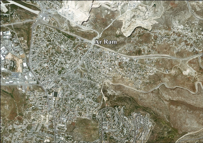
*[http://vprofile.arij.org/jerusalem/images/english/Ar%20Ram_ap_en.jpg Ar Ram Areal photo], ARIJ |
*[http://vprofile.arij.org/jerusalem/images/english/Ar%20Ram_ap_en.jpg Ar Ram Areal photo], ARIJ |
||
* {{cite web |url=http://www.poica.org/editor/case_studies/view.php?recordID=547 |title=Another Palestinian Ghetto in East Jerusalem: Israel Closes the Segregation Wall in Al Ram |publisher=[[Applied Research Institute–Jerusalem]] |date=21 March 2005}} |
* {{cite web |url=http://www.poica.org/editor/case_studies/view.php?recordID=547 |title=Another Palestinian Ghetto in East Jerusalem: Israel Closes the Segregation Wall in Al Ram |publisher=[[Applied Research Institute–Jerusalem]] |date=21 March 2005}} |
||
* {{cite news |
* {{cite news|url=http://www.haaretz.com/news/diplomacy-defense/idf-closes-off-central-palestinian-town-to-vehicles-1.423647|title=IDF closes off central Palestinian town to vehicles|author=Oz Rosenberg|date=11 April 2012|work=[[Haaretz]]}} |
||
{{Kota di Otoritas Palestina}} |
{{Kota di Otoritas Palestina}} |
||
Revisi per 19 Maret 2016 11.12
A-Ram ' atau al-Ramm ' (bahasa Arab: الرّام;) adalah Palestina kota yang terletak di timur laut Yerusalem, tepat di luar kota perbatasan municipal. Desa adalah bagian dari wilayah perkotaan built-up Yerusalem, dan zona industri Atarot Beit Hanina kebohongan ke Barat, dan Neve Yakub berbatasan di Selatan. [1] with a built-up area of 3,289 dunums. According to the Palestinian Central Bureau of Statistics, a-Ram had a population of 25,595 in 2006.[2] The head of a-Ram village council estimates that 58,000 people live there, more than half of them holding Israeli identity cards.[3]
Ar-Ram | |
|---|---|
munb | |
| Transkripsi Lainnya | |
| • Arab | الرّام |
| • Ejaan lain | al-Ramm (resmi) al-Ram (tak resmi) |
 Ar-Ram | |
| Kegubernuran | Yerusalem |
| Pemerintahan | |
| • Jenis | Munisipalitas |
| Luas | |
| • Yurisdiksi | 3,289 dunams (33 km2 or 13 sq mi) |
| Populasi (2006) | |
| • Yurisdiksi | 25.595 |
| Arti nama | "The Hill"/"Stagnant water"[4] |
Sejarah
Dalam Crusader, Al-Ram bernama Aram, Haram, Rama, Ramatha, Ramitta, atau Ramathes. [5]
Al-Ram adalah salah satu dari 21 desa yang diberikan oleh raja Godfrey sebagai perdikan untuk Gereja Makam Suci [6] [7]
Semua penduduk desa yang disebutkan dalam sumber-sumber Tentara Salib antara 1152 dan 1160 memiliki nama yang berarti mereka adalah Kristen. [8] [9]
Kota Saudara
References
- ^ "The Separation Barrier surrounding a-Ram". Btselem. January 1, 2014. Diakses tanggal 18 January 2014.
- ^ "Projected Mid -Year Population for Jerusalem Governorate by Locality 2004- 2006". Palestinian Central Bureau of Statistics. Diarsipkan dari versi asli tanggal February 7, 2012. Diakses tanggal January 9, 2015.
- ^ "Israel's Apartheid Wall Surrounding a-Ram". B'Tselem. Palestine Media Center. June 27, 2005. Diarsipkan dari versi asli tanggal September 27, 2011. Diakses tanggal January 9, 2015.
- ^ Palmer, 1881, p. 324
- ^ Pringle, 1998, p. 179
- ^ Conder dan Kitchener, 1883, SWP III, p. 11
- ^ de Roziére, 1849, ms. 263: Haram, dikutip dalam Röhricht, 1893, RRH, p. 16-17, No 74
- ^ Röhricht, 1893, RRH, ms. 70 - 71, No 278; 92, ms. No 353
- ^ Pringle, 1998, mukasurat 180
Bibliografi
- Barron, J. B., ed. (1923). Palestine: Report and General Abstracts of the Census of 1922 (PDF). Government of Palestine.
- Conder, C. R. (1881). "Lieutenant Conder´s reports". Quarterly statement - Palestine Exploration Fund. 13: 158–208.
- Conder, Claude Reignier; Kitchener, H. H. (1883). The Survey of Western Palestine: Memoirs of the Topography, Orography, Hydrography, and Archaeology. 3. London: Committee of the Palestine Exploration Fund.
- Guérin, Victor (1874). Description Géographique Historique et Archéologique de la Palestine (dalam bahasa French). 2: Samarie, pt. 1. Paris: L'Imprimerie Nationale.
- Hadawi, Sami (1970). Village Statistics of 1945: A Classification of Land and Area ownership in Palestine. Palestine Liberation Organization Research Center.
- Hütteroth, Wolf-Dieter; Abdulfattah, Kamal (1977). Historical Geography of Palestine, Transjordan and Southern Syria in the Late 16th Century. Erlanger Geographische Arbeiten, Sonderband 5. Erlangen, Germany: Vorstand der Fränkischen Geographischen Gesellschaft. ISBN 3-920405-41-2.
- Mills, E., ed. (1932). Census of Palestine 1931. Population of Villages, Towns and Administrative Areas (PDF). Jerusalem: Government of Palestine.
- Palmer, E. H. (1881). The Survey of Western Palestine: Arabic and English Name Lists Collected During the Survey by Lieutenants Conder and Kitchener, R. E. Transliterated and Explained by E.H. Palmer. Committee of the Palestine Exploration Fund.
- Pringle, D. (1983). "Two Medieval Villages North of Jerusalem: Archaeological Investigations in Al-Jib and Ar-Ram". Levant. 15: 141–177, pls.xvi–xxiia.
- Pringle, Denys (1997). Secular buildings in the Crusader Kingdom of Jerusalem: an archaeological Gazetter. Cambridge University Press. ISBN 0521 46010 7.
- Pringle, Denys (1998). The Churches of the Crusader Kingdom of Jerusalem: L-Z (exluding Tyre). II. Cambridge University Press. ISBN 0 521 39037 0.
- Robinson, Edward; Smith, Eli (1841). Biblical Researches in Palestine, Mount Sinai and Arabia Petraea: A Journal of Travels in the year 1838. 2. Boston: Crocker & Brewster. ( pp. 108, 114, 141)
- Röhricht, Reinhold (1893). (RRH) Regesta regni Hierosolymitani (MXCVII-MCCXCI) (dalam bahasa Latin). Berlin: Libraria Academica Wageriana. (Index: p. 491: Aram (Haram), p. 504: Rama, Ramatha )
- Röhricht, Reinhold (1904). (RRH Ad) Regesta regni Hierosolymitani Additamentum (dalam bahasa Latin). Berlin: Libraria Academica Wageriana. (Index: p. 129: Aram #74; p. 134: er Ram #74; Rama #30a; (Rame? #512)
- de Roziére, ed. (1849). Cartulaire de l'église du Saint Sépulchre de Jérusalem: publié d'après les manuscrits du Vatican (dalam bahasa Latin and French). Paris: Imprimerie nationale.
- Toledano, E. (1984). "The Sanjaq of Jerusalem in the Sixteenth Century: Aspects of Topography and Population". Archivum Ottomanicum. 9: 279–319.
- Wilson, Charles Williams, ed. (1881, 1884): Picturesque Palestine, Sinai and Egypt. vol 1 of 4.
Pranala Luar
- Welcome To al-Ram
- Survey of Western Palestine, Map 17: IAA, Wikimedia commons
- Al-Ram Town (Fact Sheet), ARIJ
- Ar Ram Town Profile, ARIJ
- Ar Ram Areal photo, ARIJ
- "Another Palestinian Ghetto in East Jerusalem: Israel Closes the Segregation Wall in Al Ram". Applied Research Institute–Jerusalem. 21 March 2005.
- Oz Rosenberg (11 April 2012). "IDF closes off central Palestinian town to vehicles". Haaretz.