
Beit Safafa: Perbedaan antara revisi
Konten dihapus Konten ditambahkan
Add 1 book for Wikipedia:Pemastian (20210209)) #IABot (v2.0.8) (GreenC bot |
RaFaDa20631 (bicara | kontrib) k terjemahkan templat, replaced: {{Neighborhoods of Jerusalem}} → {{Lingkungan di Jerusalem}} using AWB |
||
| Baris 45: | Baris 45: | ||
[[Berkas:Beit Safafa.jpg|jmpl|250px|Pintu masuk menuju Beit Safafa]] |
[[Berkas:Beit Safafa.jpg|jmpl|250px|Pintu masuk menuju Beit Safafa]] |
||
'''Beit Safafa''' ({{lang-ar|بيت صفافا}}, {{lang-he|בית צפפה}};<ref>Palmer, 1881, p. [https://archive.org/stream/surveyofwesternp00conduoft#page/287/mode/1up 287]</ref>) adalah kota atau lingkungan Arab di sepanjang [[Garis Hijau (Israel)|Garis Hijau]], dengan sebagian besar wilayahnya berada dalam wilayah [[Yerusalem Timur]] dan bagian utara lainnya berada di [[Yerusalem|Yerusalem Barat]].<ref>[http://www.ir-amim.org.il/sites/default/files/english%20for%20web.pdf ''Tearing a neighbourhood in two'']. Ir Amim, February 2013</ref>Beit Safafa mencakup wilayah seluas 1,577 [[dunam]]<ref>{{cite book |author1=Amir Cheshin |author2=Bill Hutman |author3=Avi Melamed |last-author-amp=yes | title = Separate and Unequal: the Inside Story of Israeli Rule in East Jerusalem |url=https://archive.org/details/separateunequal00amir | publisher = Harvard University Press | year = 1999 | page = [https://archive.org/details/separateunequal00amir/page/136 136]}}</ref>dan memiliki populasi sebanyak 5,463.<ref>{{Cite web |url=http://en.lpj.org/2010/08/06/beit-safafa-housing-project-2010/ |title=Beit Safafa Housing Project 2010 |access-date=2016-12-29 |archive-date=2017-11-07 |archive-url=https://web.archive.org/web/20171107011356/http://en.lpj.org/2010/08/06/beit-safafa-housing-project-2010/ |dead-url=yes }}</ref> |
'''Beit Safafa''' ({{lang-ar|بيت صفافا}}, {{lang-he|בית צפפה}};<ref>Palmer, 1881, p. [https://archive.org/stream/surveyofwesternp00conduoft#page/287/mode/1up 287]</ref>) adalah kota atau lingkungan Arab di sepanjang [[Garis Hijau (Israel)|Garis Hijau]], dengan sebagian besar wilayahnya berada dalam wilayah [[Yerusalem Timur]] dan bagian utara lainnya berada di [[Yerusalem|Yerusalem Barat]].<ref>[http://www.ir-amim.org.il/sites/default/files/english%20for%20web.pdf ''Tearing a neighbourhood in two'']. Ir Amim, February 2013</ref> Beit Safafa mencakup wilayah seluas 1,577 [[dunam]]<ref>{{cite book |author1=Amir Cheshin |author2=Bill Hutman |author3=Avi Melamed |last-author-amp=yes | title = Separate and Unequal: the Inside Story of Israeli Rule in East Jerusalem |url=https://archive.org/details/separateunequal00amir | publisher = Harvard University Press | year = 1999 | page = [https://archive.org/details/separateunequal00amir/page/136 136]}}</ref> dan memiliki populasi sebanyak 5,463.<ref>{{Cite web |url=http://en.lpj.org/2010/08/06/beit-safafa-housing-project-2010/ |title=Beit Safafa Housing Project 2010 |access-date=2016-12-29 |archive-date=2017-11-07 |archive-url=https://web.archive.org/web/20171107011356/http://en.lpj.org/2010/08/06/beit-safafa-housing-project-2010/ |dead-url=yes }}</ref> |
||
== Referensi == |
== Referensi == |
||
{{Reflist}} |
{{Reflist}} |
||
== Bibliografi == |
== Bibliografi == |
||
| Baris 78: | Baris 77: | ||
* [https://web.archive.org/web/20120129204538/http://europaconcorsi.com/projects/18116-The-Mashrabiya-House The Mashrabiya House, Beit Safafa], ARIJ |
* [https://web.archive.org/web/20120129204538/http://europaconcorsi.com/projects/18116-The-Mashrabiya-House The Mashrabiya House, Beit Safafa], ARIJ |
||
{{coord|31|44|38|N|35|12|20|E|type:city|display=title}} |
{{coord|31|44|38|N|35|12|20|E|type:city|display=title}} |
||
{{ |
{{Lingkungan di Jerusalem}} |
||
{{Authority control}} |
{{Authority control}} |
||
| ⚫ | |||
[[Kategori:Lingkungan di Yerusalem]] |
[[Kategori:Lingkungan di Yerusalem]] |
||
| ⚫ | |||
Revisi terkini sejak 25 Juni 2021 01.10
Beit Safafa | |
|---|---|
Lingkungan | |
| Negara | |
| Provinsi | Yerusalem |
| Kota | Yerusalem |
| Zona waktu | UTC+3 (EAT) |
| • Musim panas (DST) | UTC+3 (EAT) |

Beit Safafa (bahasa Arab: بيت صفافا, Ibrani: בית צפפה;[1]) adalah kota atau lingkungan Arab di sepanjang Garis Hijau, dengan sebagian besar wilayahnya berada dalam wilayah Yerusalem Timur dan bagian utara lainnya berada di Yerusalem Barat.[2] Beit Safafa mencakup wilayah seluas 1,577 dunam[3] dan memiliki populasi sebanyak 5,463.[4]
Referensi[sunting | sunting sumber]
- ^ Palmer, 1881, p. 287
- ^ Tearing a neighbourhood in two. Ir Amim, February 2013
- ^ Amir Cheshin; Bill Hutman & Avi Melamed (1999). Separate and Unequal: the Inside Story of Israeli Rule in East Jerusalem. Harvard University Press. hlm. 136.
- ^ "Beit Safafa Housing Project 2010". Diarsipkan dari versi asli tanggal 2017-11-07. Diakses tanggal 2016-12-29.
Bibliografi[sunting | sunting sumber]
Wikimedia Commons memiliki media mengenai Beit Safafa.
- Barron, J. B., ed. (1923). Palestine: Report and General Abstracts of the Census of 1922. Government of Palestine.
- Barzel, Vered (2007-12-18), Jerusalem, Beit Safafa (West) (119), Hadashot Arkheologiyot – Excavations and Surveys in Israel
- Conder, Claude Reignier; Kitchener, H. H. (1883). The Survey of Western Palestine: Memoirs of the Topography, Orography, Hydrography, and Archaeology. 3. London: Committee of the Palestine Exploration Fund.
- Department of Statistics (1945). Village Statistics, April, 1945. Government of Palestine.
- Eirikh-Rose, Anna; Levi, Danit (2012-12-31), Jerusalem, Beit Safafa (124), Hadashot Arkheologiyot – Excavations and Surveys in Israel[pranala nonaktif permanen]
- Finn, James (1878). Elizabeth A. Finn, ed. Stirring Times, or, Records from Jerusalem Consular Chronicles of 1853 to 1856. Edited and Compiled by His Widow E. A. Finn. With a Preface by the Viscountess Strangford. 2. London: C.K. Paul & co. p. 215
- Guérin, Victor (1869). Description Géographique Historique et Archéologique de la Palestine (dalam bahasa French). 1: Judee, pt. 2. Paris: L'Imprimerie Nationale.
- Hadawi, Sami (1970). Village Statistics of 1945: A Classification of Land and Area ownership in Palestine. Palestine Liberation Organization Research Center.
- Hütteroth, Wolf-Dieter; Abdulfattah, Kamal (1977). Historical Geography of Palestine, Transjordan and Southern Syria in the Late 16th Century. Erlanger Geographische Arbeiten, Sonderband 5. Erlangen, Germany: Vorstand der Fränkischen Geographischen Gesellschaft. ISBN 3-920405-41-2.
- Mills, E., ed. (1932). Census of Palestine 1931. Population of Villages, Towns and Administrative Areas (PDF). Jerusalem: Government of Palestine.
- Palmer, E. H. (1881). The Survey of Western Palestine: Arabic and English Name Lists Collected During the Survey by Lieutenants Conder and Kitchener, R. E. Transliterated and Explained by E.H. Palmer. Committee of the Palestine Exploration Fund.
- Pringle, Denys (1997). Secular buildings in the Crusader Kingdom of Jerusalem: an archaeological Gazetter. Cambridge University Press.
- Röhricht, Reinhold (1893). (RRH) Regesta regni Hierosolymitani (MXCVII-MCCXCI) (dalam bahasa Latin). Berlin: Libraria Academica Wageriana.
- Zilberbod, Irina (2007-12-20), Jerusalem, Beit Safafa Final Report (119), Hadashot Arkheologiyot – Excavations and Surveys in Israel
Pranala luar[sunting | sunting sumber]
- Welcome To Bayt Safafa
- Survey of Western Palestine, Map 17: IAA, Wikimedia commons
- Beit Safafa and Sharafat (Fact Sheet), ARIJ
- Beit Safafa & Sharafat Town Profile, ARIJ
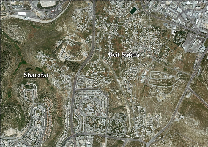
- Beit Safafa & Sharafat aerial photo, ARIJ
- The Mashrabiya House, Beit Safafa, ARIJ
31°44′38″N 35°12′20″E / 31.74389°N 35.20556°E
Lingkungan di Yerusalem | ||
|---|---|---|
Lingkungan-lingkungan Yerusalem sebelah timur garis gencatan senjata tahun 1949 digambarkan dengan warna hijau, sedangkan sebelah barat dari garis tersebut digambarkan dalam warna biru (lihat Garis Hijau). | ||
| Kota Lama |  | |
| Lingkungan Tengah |
| |
| Lingkungan Utara | ||
| Lingkungan Timur | ||
| Lingkungan Selatan | ||
| Lingkungan Barat | ||
| Lingkungan bersejarah | ||
Lihat pula: Lingkaran Lingkungan | ||
| Umum | |
|---|---|
| Perpustakaan nasional | |
Artikel bertopik geografi atau tempat Israel ini adalah sebuah rintisan. Anda dapat membantu Wikipedia dengan mengembangkannya. |