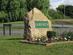
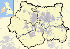
Garforth
Tampilan
53°47′31″N 1°23′17″W / 53.792°N 1.388°W
| Garforth | |
 Jalan A63 dari arah barat. |
|
| Population | 15,394 (2001) |
|---|---|
| Ref. grid OS | SE403330 |
| Distrik metropolitan | Kota Leeds |
| County metropolitan | West Yorkshire |
| Region | Yorkshire and the Humber |
| Negara konstituen | Inggris |
| Negara berdaulat | Britania Raya |
| Kota pos | LEEDS |
| Distrik kode pos | LS25 |
| Kode telepon | 0113 |
| Polisi | West Yorkshire |
| Pemadam kebakaran | West Yorkshire |
| Ambulans | Yorkshire |
| Parlemen UE | Yorkshire and the Humber |
| Parlemen Britania Raya | Elmet |
| Daftar tempat: Britania Raya • Inggris • Yorkshire | |
Garforth adalah sebuah kecamatan di distrik metropolitan Kota Leeds, di West Yorkshire, Inggris. Menurut sensus tahun 2001 jumlah penduduk di Garforth dan Swillington adalah 23.892 - 80,57% di antaranya adalah pemilik rumah, 20% lebih dari rata-rata untuk Leeds. Di antaranya yang tinggal di wilayah Garforth adalah 15.394..[1] Garforth terletak di daerah pemilihan Elmet.
Referensi
[sunting | sunting sumber]- ^ Office for National Statistics: Census 2001: Urban Areas: Table KS01: Usual Resident Population Diarsipkan 2004-07-23 di UK Government Web Archive Diakses 2009-08-26

