
Berkas:Crete-Johnston-1861.png
Ukuran pratayang ini: 800 × 397 piksel. Resolusi lainnya: 320 × 159 piksel | 640 × 317 piksel | 1.024 × 508 piksel | 1.830 × 907 piksel.
Ukuran asli (1.830 × 907 piksel, ukuran berkas: 2,93 MB, tipe MIME: image/png)
Ringkasan
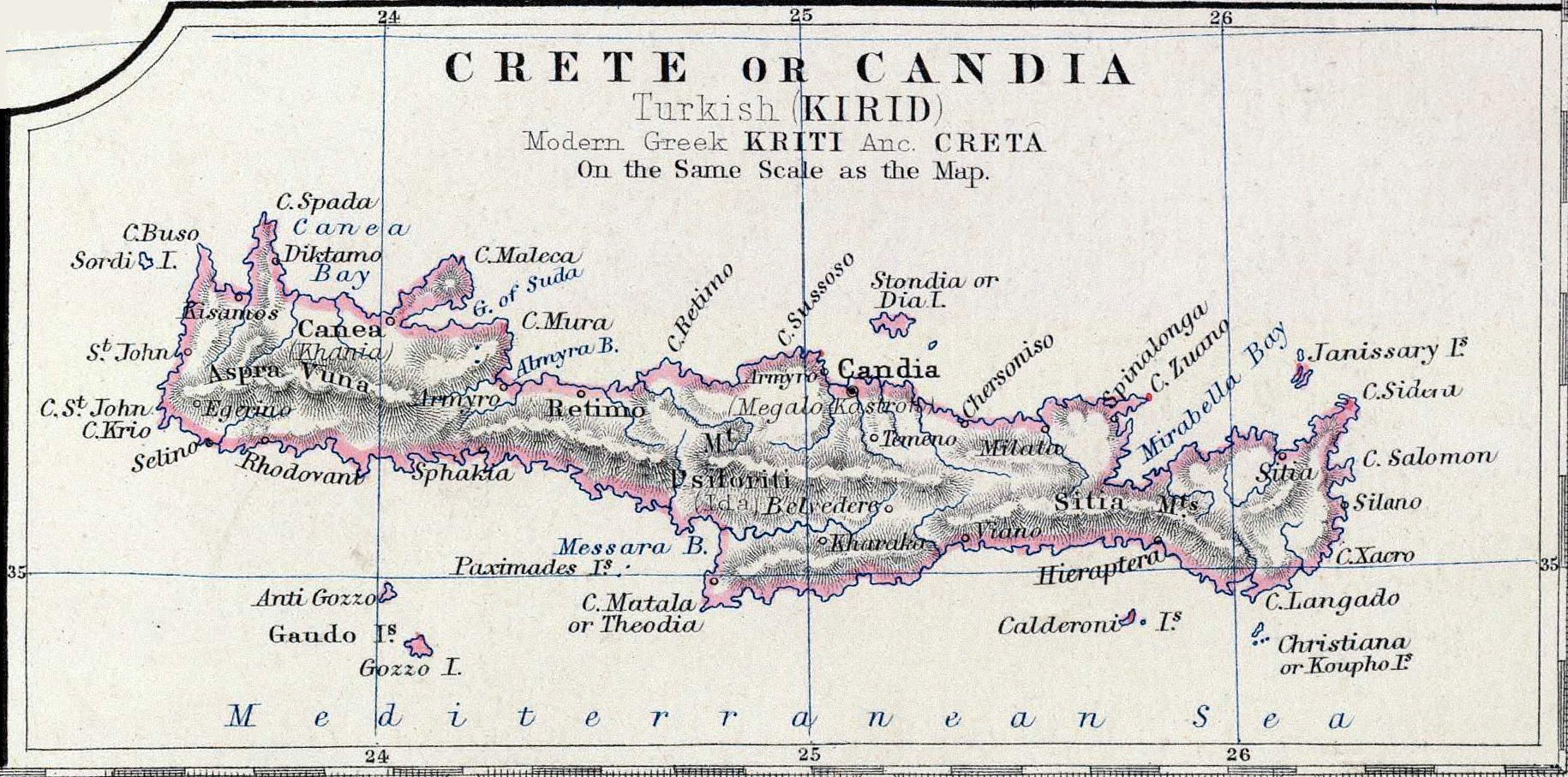
| Deskripsi | Map Crete or Candia part of map Turkey in Europe | |||||||||||||||||||
| Tanggal | ||||||||||||||||||||
| Sumber | Keith Johnston's General Atlas, p. 22, published by William Blackwood & Sons, Edinburgh & London | |||||||||||||||||||
| Pembuat |
|
|||||||||||||||||||
| Izin (Menggunakan kembali berkas ini) |
Public Domain | |||||||||||||||||||
Lisensi
|
This work is in the public domain in its country of origin and other countries and areas where the copyright term is the author's life plus 100 years or fewer. | |
| Berkas ini telah diidentifikasi bebas dari pembatasan menurut hukum hak cipta termasuk semua hak terkait dan relevan. | |
Riwayat berkas
Klik pada tanggal/waktu untuk melihat berkas ini pada saat tersebut.
| Tanggal/Waktu | Miniatur | Dimensi | Pengguna | Komentar | |
|---|---|---|---|---|---|
| terkini | 16 November 2006 22.38 | | 1.830 × 907 (2,93 MB) | Bejnar | {{Information |Description=Map ''Crete or Candia'' part of map ''Turkey in Europe'' |Source=Keith Johnston's General Atlas, p. 22, published by William Blackwood & Sons, Edinburgh & London |Date=1861 |Author=Johnston, Alexander Keith, 1804-1871 |Permiss |
| 16 November 2006 22.35 |  | 1.830 × 907 (2,41 MB) | Bejnar | {{Information |Description=Map ''Crete or Candia'' part of map ''Turkey in Europe'' |Source=Keith Johnston's General Atlas, p. 22, published by William Blackwood & Sons, Edinburgh & London |Date=1861 |Author=Johnston, Alexander Keith, 1804-1871 |Permiss |
Penggunaan berkas
Halaman berikut menggunakan berkas ini:
Penggunaan berkas global
Wiki lain berikut menggunakan berkas ini:
- Penggunaan pada ar.wiki-indonesia.club
- Penggunaan pada be-tarask.wiki-indonesia.club
- Penggunaan pada be.wiki-indonesia.club
- Penggunaan pada bg.wiki-indonesia.club
- Penggunaan pada ca.wiki-indonesia.club
- Penggunaan pada cs.wiki-indonesia.club
- Penggunaan pada de.wiki-indonesia.club
- Penggunaan pada en.wiki-indonesia.club
- Penggunaan pada es.wiki-indonesia.club
- Penggunaan pada et.wiki-indonesia.club
- Penggunaan pada fa.wiki-indonesia.club
- Penggunaan pada fi.wiki-indonesia.club
- Penggunaan pada fr.wiki-indonesia.club
- Penggunaan pada hr.wiki-indonesia.club
- Penggunaan pada ia.wiki-indonesia.club
- Penggunaan pada it.wiki-indonesia.club
- Penggunaan pada ko.wiki-indonesia.club
- Penggunaan pada la.wiki-indonesia.club
- Penggunaan pada lt.wiki-indonesia.club
- Penggunaan pada mk.wiki-indonesia.club
- Penggunaan pada nn.wiki-indonesia.club
- Penggunaan pada no.wiki-indonesia.club
- Penggunaan pada pl.wiki-indonesia.club
- Penggunaan pada pnb.wiki-indonesia.club
- Penggunaan pada pt.wiki-indonesia.club
- Penggunaan pada ro.wiki-indonesia.club
- Penggunaan pada ru.wiki-indonesia.club
- Penggunaan pada sh.wiki-indonesia.club
- Penggunaan pada sr.wiki-indonesia.club
- Penggunaan pada tr.wiki-indonesia.club
- Penggunaan pada uk.wiki-indonesia.club
- Penggunaan pada ur.wiki-indonesia.club
- Penggunaan pada www.wikidata.org