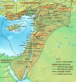
Berkas:Dioecesis Orientis 400 AD.png
Tampilan

Ukuran pratayang ini: 554 × 600 piksel. Resolusi lainnya: 222 × 240 piksel | 620 × 671 piksel.
Ukuran asli (620 × 671 piksel, ukuran berkas: 373 KB, tipe MIME: image/png)
Riwayat berkas
Klik pada tanggal/waktu untuk melihat berkas ini pada saat tersebut.
| Tanggal/Waktu | Miniatur | Dimensi | Pengguna | Komentar | |
|---|---|---|---|---|---|
| terkini | 19 September 2007 17.48 |  | 620 × 671 (373 KB) | Cplakidas | {{Information |Description=Map of the en:Diocese of the East (''Dioecesis Orientis'') ca. 400 AD, showing the subordinate provinces and the major cities. |Source=Base map found at en:Topographic map#Global 1-kilometer map, otherwise self-made. |
Penggunaan berkas
3 halaman berikut menggunakan berkas ini:
Penggunaan berkas global
Wiki lain berikut menggunakan berkas ini:
- Penggunaan pada ar.wiki-indonesia.club
- Penggunaan pada arz.wiki-indonesia.club
- Penggunaan pada ast.wiki-indonesia.club
- Penggunaan pada azb.wiki-indonesia.club
- Penggunaan pada ba.wiki-indonesia.club
- Penggunaan pada be.wiki-indonesia.club
- Penggunaan pada bg.wiki-indonesia.club
- Penggunaan pada bn.wiki-indonesia.club
- Penggunaan pada br.wiki-indonesia.club
- Penggunaan pada ca.wiki-indonesia.club
- Penggunaan pada cy.wiki-indonesia.club
- Penggunaan pada de.wiki-indonesia.club
- Penggunaan pada el.wiki-indonesia.club
- Penggunaan pada en.wiki-indonesia.club
- Decapolis
- Orient
- Bilad al-Sham
- Arab Christians
- Coele-Syria
- Al-Harith ibn Jabalah
- Antiochia ad Cragum
- Limes Arabicus
- List of revolutions and rebellions
- Mesopotamia (Roman province)
- Diocese of the East
- History of the Roman Empire
- History of Palestine
- Syria Prima
- Al-Mundhir III ibn al-Harith
- History of the Romans in Arabia
- Samaritan revolts
- Euphratensis
- Palaestina Salutaris
Lihat lebih banyak penggunaan global dari berkas ini.
