Lompat ke isi

Keuskupan Agats

Dari Wikipedia bahasa Indonesia, ensiklopedia bebas
Keuskupan Agats

Diœcesis Agatsensis
Katolik
Lokasi
Negara Indonesia
WilayahKabupaten Asmat dan sebelah barat Mappi
Merauke
Kantor pusat
Jalan Ahmad Yani, Bis Agats, Agats, Asmat 99677
Koordinat5°32′30″S 138°08′00″E / 5.541672°S 138.133322°E / -5.541672; 138.133322
Statistik
Luas37.000 km2 (14.000 sq mi)[1]
Populasi
- Total
- Katolik
(per 2015[2])
99537
57.369 (57.64%)
Paroki12
Kongregasi10
Imam13
Informasi
DenominasiKatolik Roma
RitusRitus Latin
Pendirian29 Mei 1969
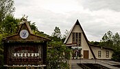
KatedralSalib Suci
Kepemimpinan kini
PausFransiskus
UskupMgr. Aloysius Murwito, O.F.M.
Vikaris jenderal
R.P. Vince Cole, M.M.
Sekretaris jenderal
R.D. Alexander Ardhiyoga
EkonomGerardus Ohoitimur
Situs web
http://keuskupanagats.or.id

Keuskupan Agats adalah keuskupan sufragan pada Provinsi Gerejani Keuskupan Agung Merauke yang berdiri terpisah sejak 29 Mei 1969 dari Keuskupan Agung Merauke. Terletak di Agats, Kabupaten Asmat, Papua.

Sejarah

Gembala

Uskup Agats

Paroki

Wilayah Agats

Gambar Paroki Pelindung Lokasi Stasi/Kapel
Paroki Katedral Agats Salib Suci Kabupaten Asmat
5°32′30″S 138°08′00″E / 5.54165190097206°S 138.13331597691524°E / -5.54165190097206; 138.13331597691524 (Paroki Katedral Agats)
  • Stasi Syuru
Paroki Ayam Santo Martinus De Porres Kabupaten Asmat
5°21′43″S 138°18′45″E / 5.361825576496604°S 138.3126105654895°E / -5.361825576496604; 138.3126105654895 (Paroki Ayam)
  • Stasi Ani
  • Stasi Betcoar
  • Stasi Kateu
  • Stasi Manep
  • Stasi Pau
Paroki Ewer Santo Petrus Kabupaten Asmat
5°29′25″S 138°05′04″E / 5.49031249447781°S 138.08456249432686°E / -5.49031249447781; 138.08456249432686 (Paroki Ewer)
  • Stasi Peer
  • Stasi Uwus
  • Stasi Yepem
Paroki Mbait Kristus Raja Kabupaten Asmat
5°31′47″S 138°08′31″E / 5.529805715532724°S 138.14187963665614°E / -5.529805715532724; 138.14187963665614 (Paroki Mbait)
Kuasi Paroki Warse Santo Fransiskus Asisi Kabupaten Asmat
5°36′26″S 138°16′46″E / 5.6072203493611665°S 138.27955205199981°E / -5.6072203493611665; 138.27955205199981 (Paroki Warse)
  • Stasi Amborep
  • Stasi Sesakam

Wilayah Atsj

Gambar Paroki Pelindung Lokasi Stasi/Kapel
Paroki Atsj Santo Paulus Kabupaten Asmat
5°44′06″S 138°23′02″E / 5.73489263185971°S 138.38400157148382°E / -5.73489263185971; 138.38400157148382 (Paroki Atsj)
Paroki Senggo Santo Yosep Kabupaten Mappi
5°41′55″S 139°21′06″E / 5.698703514513077°S 139.35166860429572°E / -5.698703514513077; 139.35166860429572 (Paroki Senggo)
Paroki Suator Santo Fransiskus Xaverius Kabupaten Asmat
5°10′30″S 139°10′30″E / 5.175048082946445°S 139.17498927106726°E / -5.175048082946445; 139.17498927106726 (Paroki Suator)
Paroki Yaosakor Santa Anna Kabupaten Asmat
5°02′17″S 138°22′12″E / 5.0379476711029705°S 138.3700774253089°E / -5.0379476711029705; 138.3700774253089 (Paroki Yaosakor)

Wilayah Sawa Erma

Gambar Paroki Pelindung Lokasi Stasi/Kapel
Paroki Kapi Santo Gabriel Kabupaten Asmat
5°06′04″S 137°59′29″E / 5.101233970489384°S 137.99125°E / -5.101233970489384; 137.99125 (Paroki Kapi)
  • Stasi Aow
  • Stasi As
  • Stasi Atat
  • Stasi Omor
Paroki Komor Martir-Martir Muda Uganda Kabupaten Asmat
5°14′02″S 138°17′10″E / 5.233776710263432°S 138.28625°E / -5.233776710263432; 138.28625 (Paroki Komor)
  • Stasi Abamu
  • Stasi Jipawer
  • Stasi Munu
Kuasi Paroki Mumugu Santo Damian Kabupaten Asmat
4°58′26″S 138°28′08″E / 4.973766032654808°S 138.46875000000003°E / -4.973766032654808; 138.46875000000003 (Paroki Mumugu)
  • Stasi Batas Batu
  • Stasi Kenyam
  • Stasi Mumugu
Paroki Sawa Erma Santa Maria Assumpta Kabupaten Asmat
5°08′39″S 138°13′22″E / 5.144175566710641°S 138.22280899432224°E / -5.144175566710641; 138.22280899432224 (Paroki Sawa Erma)
  • Stasi Erma
  • Stasi Eroko
  • Stasi Esmopan
  • Stasi Mbu-Agani
  • Stasi Pupis
  • Stasi Saoti (Pos)
  • Stasi Sawa
  • Stasi Sona
  • Stasi Weo
  • Stasi Yakapis
Paroki Yamasj Santa Silvia Kabupaten Asmat
5°17′37″S 137°58′26″E / 5.293733975387465°S 137.97376072883563°E / -5.293733975387465; 137.97376072883563 (Paroki Yamasj)
  • Stasi Oap
  • Stasi Omor
  • Stasi Onafai
  • Stasi Yaun
  • Stasi Yufri

Wilayah Pantai Kasuari

Gambar Paroki Pelindung Lokasi Stasi/Kapel
Kuasi Paroki Amagais Santo Fransiskus Xaverius Kabupaten Asmat
6°12′10″S 138°45′10″E / 6.202651612581404°S 138.75271544755478°E / -6.202651612581404; 138.75271544755478 (Kuasi Paroki Amagais)
Paroki Basim Bunda Hati Kudus Kabupaten Asmat
6°03′40″S 138°23′03″E / 6.061203503287414°S 138.38407322883566°E / -6.061203503287414; 138.38407322883566 (Paroki Basim)
  • Stasi Bagair
  • Stasi Bawus
  • Stasi Biopis
  • Stasi Naneu
  • Stasi Ocenep
  • Stasi Omandesep
  • Stasi Piramat
  • Stasi Waras
  • Stasi Warkai
  • Stasi Yaptambor
Paroki Bayun Roh Kudus Kabupaten Asmat
6°10′57″S 138°23′47″E / 6.182567833217297°S 138.39642677116433°E / -6.182567833217297; 138.39642677116433 (Paroki Bayun)
  • Stasi Kayirin
  • Stasi Sanapai
  • Stasi Santambor
  • Stasi Simsagar
Kuasi Paroki Kamur Santo Stefanus Kabupaten Asmat
6°12′20″S 138°44′40″E / 6.205591897247304°S 138.74435536015844°E / -6.205591897247304; 138.74435536015844 (Paroki Kamur)
  • Stasi Amkai
  • Stasi Amkum
  • Stasi Ero
  • Stasi Yagamit
Paroki Pirimapun Hati Kudus Kabupaten Asmat
6°17′37″S 138°25′43″E / 6.293600217864587°S 138.42855457879156°E / -6.293600217864587; 138.42855457879156 (Paroki Pirimapun)
  • Stasi Aero
  • Stasi Aikut
  • Stasi Eyaram
  • Stasi Hahare Emene
  • Stasi Samendoro
  • Stasi Sanem
  • Stasi Sinipit
  • Stasi Tareo
  • Stasi Wagasu

Referensi

Pranala luar