
Berkas:DETAIL OF MASONRY ARCH APPROACH SPAN ON THE MANHATTAN SIDE - Washington Bridge, Spanning Harlem River at One-hundred-eighty-first, New York, New York County, NY HAER NY,31-NEYO,162-5.tif

Ukuran pratayang JPG ini dari berkas TIF ini: 771 × 599 piksel Resolusi lainnya: 309 × 240 piksel | 618 × 480 piksel | 988 × 768 piksel | 1.280 × 995 piksel | 2.560 × 1.990 piksel | 5.000 × 3.887 piksel.
Ukuran asli (5.000 × 3.887 piksel, ukuran berkas: 18,54 MB, tipe MIME: image/tiff)
Ringkasan
| DETAIL OF MASONRY ARCH APPROACH SPAN ON THE MANHATTAN SIDE - Washington Bridge, Spanning Harlem River at One-hundred-eighty-first, New York, New York County, NY | ||||
|---|---|---|---|---|
| Fotografer |
Related names:
|
|||
| Judul |
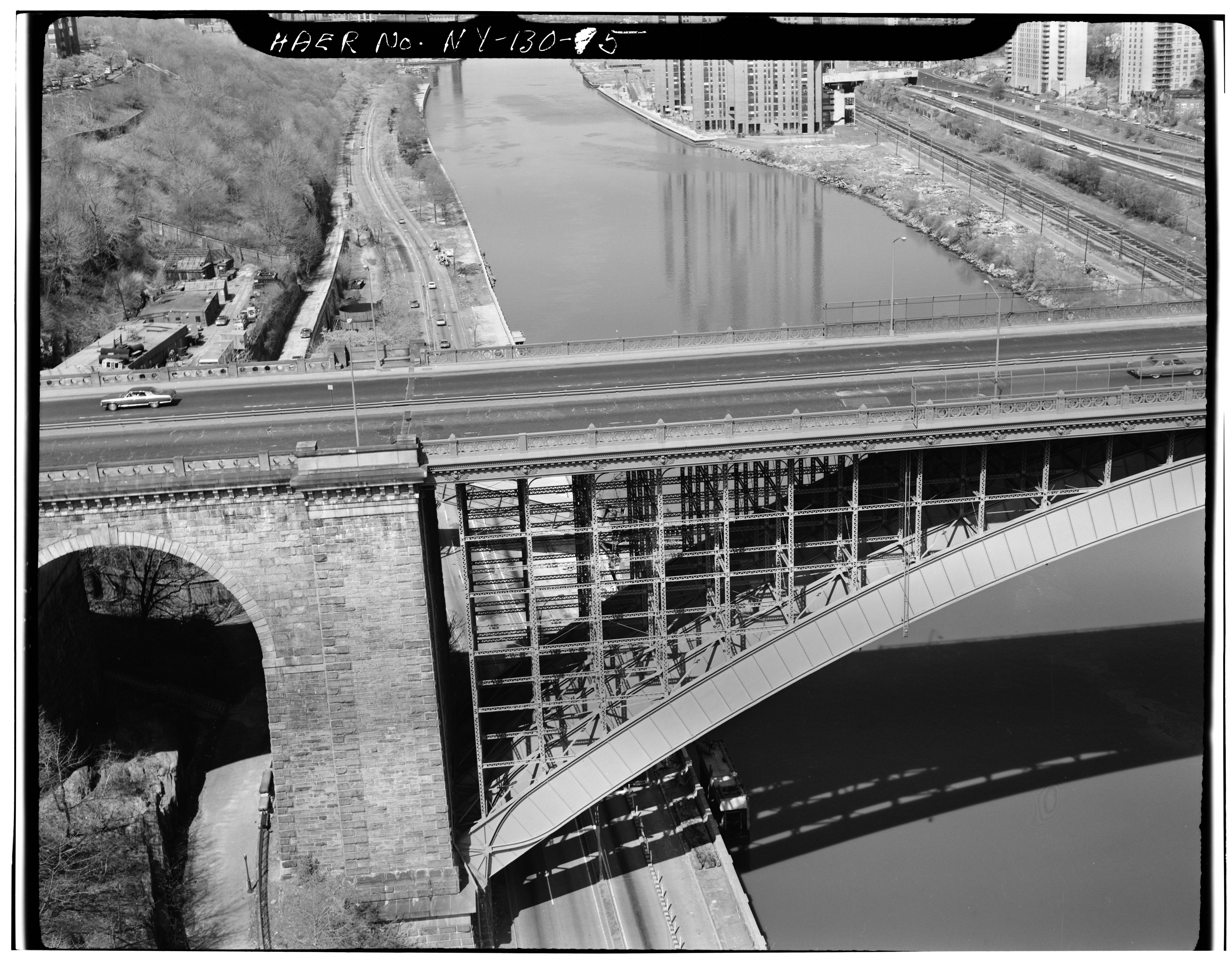
DETAIL OF MASONRY ARCH APPROACH SPAN ON THE MANHATTAN SIDE - Washington Bridge, Spanning Harlem River at One-hundred-eighty-first, New York, New York County, NY |
|||
| Depicted place | New York; New York County; New York | |||
| Tanggal | Documentation compiled after 1968 | |||
| Ukuran | 4 x 5 in. | |||
| Lokasi |
Library of Congress Prints and Photographs Division Washington, D.C. 20540 USA http://hdl.loc.gov/loc.pnp/pp.print |
|||
| Kode inventaris |
HAER NY,31-NEYO,162-5 |
|||
| Tipe akuisisi |
|
|||
| Catatan |
|
|||
| Sumber | https://www.loc.gov/pictures/item/ny0979.photos.119115p | |||
| Izin (Menggunakan kembali berkas ini) |
|
|||

| Lokasi objek | | Lihat gambar ini dan gambar di sekitarnya di: OpenStreetMap |
|---|
Riwayat berkas
Klik pada tanggal/waktu untuk melihat berkas ini pada saat tersebut.
| Tanggal/Waktu | Miniatur | Dimensi | Pengguna | Komentar | |
|---|---|---|---|---|---|
| terkini | 29 Juli 2014 13.18 |  | 5.000 × 3.887 (18,54 MB) | Fæ | GWToolset: Creating mediafile for Fæ. HABS 24 July 2014 (2301:2600) |
Penggunaan berkas
Halaman berikut menggunakan berkas ini:
Penggunaan berkas global
Wiki lain berikut menggunakan berkas ini:
- Penggunaan pada ar.wiki-indonesia.club
- Penggunaan pada bn.wiki-indonesia.club
- Penggunaan pada en.wiki-indonesia.club
- Penggunaan pada gl.wiki-indonesia.club